🕌 Faizan-E-Farooq-E-Azam
📩 Address: 148 Somerville road, Chadwell Heath, London, RM9 6DJ
☎️ Contact: n/a 🧕👨 Gender: Male
🏪 Type: Masjid/Mosque
📊 Data Accuracy: A - Excellent
📑 Additional Information
🔔 Following: Sunni- Ahlay-Sunnah wal-Jamat/ Dawat-e-islami
👨👨Management: Pakistani
📜 Other Names: Faizan e Farooq e Azam
👨👩👧👦 Capacity: 100
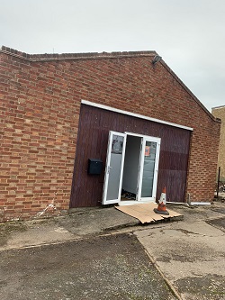
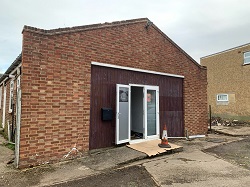
🖼️ Mosque Photo Gallery
⏰ Prayer Times
Date | Fajr | Dhuhr | Asr | Maghrib | Isha |
---|---|---|---|---|---|
08/05/25 | 03:14 AM | 12:56 PM | 05:04 PM | 08:35 PM | 10:40 PM |
09/05/25 | 03:11 AM | 12:56 PM | 05:04 PM | 08:37 PM | 10:43 PM |
10/05/25 | 03:08 AM | 12:56 PM | 05:05 PM | 08:38 PM | 10:46 PM |
11/05/25 | 03:05 AM | 12:56 PM | 05:06 PM | 08:40 PM | 10:48 PM |
12/05/25 | 03:04 AM | 12:56 PM | 05:06 PM | 08:41 PM | 10:49 PM |
13/05/25 | 03:04 AM | 12:56 PM | 05:07 PM | 08:43 PM | 10:50 PM |
14/05/25 | 03:03 AM | 12:56 PM | 05:07 PM | 08:44 PM | 10:50 PM |
15/05/25 | 03:02 AM | 12:56 PM | 05:08 PM | 08:46 PM | 10:51 PM |
16/05/25 | 03:01 AM | 12:56 PM | 05:09 PM | 08:47 PM | 10:52 PM |
17/05/25 | 03:01 AM | 12:56 PM | 05:09 PM | 08:49 PM | 10:53 PM |
🌦️ Current Weather
Location: Dagenham, Essex, UK
Local Time: 2025-05-08 06:17
Weather: Overcast
Temperature
9.3 ℃ (48.7 ℉)
Wind
7.8 mph (12.6 kph)
Degree: 31
Direction: NNE
Gust: 10.7 mph (17.2 kph)
Weather Report
Today on May 8, 2025, the temperature will be 9.3℃ (48.7℉). It will feel like 7.4℃ (45.3℉). The wind will be 7.8 mph (12.6 kph) and humidity will be 81%.
🌤️ 3-Day Forecast
Date | Condition | Max Temp (℃/℉) | Min Temp (℃/℉) |
---|---|---|---|
![]() | Patchy rain nearby | 15.9 ℃ (60.6 ℉) | 4.9 ℃ (40.8 ℉) |
![]() | Sunny | 16.6 ℃ (61.8 ℉) | 5.9 ℃ (42.7 ℉) |
![]() | Sunny | 17.7 ℃ (63.9 ℉) | 7.6 ℃ (45.7 ℉) |
🚎 Nearby Transport Links with Timetables
Loading travel information, please wait...
👨💼 Local Parliamentary Information
Display As: Nesil Caliskan | List As: Caliskan, Nesil |
MP Name: Nesil Caliskan MP | Gender: Female |
Constituency: Barking | Party Name: Labour |
Mp parliamentary email: nesil.caliskan.mp@parliament.uk | Mp constituency email: nesil.caliskan.casework@parliament.uk |
House Start Date: 2024-07-04 | Status: Current Member |
👮 Local Crime Data
Crime Data for Latitude: 51.53988120, Longitude: 0.13851540
Crime Categories (Highest Count First)
Category | Count | Action | |
---|---|---|---|
VIOLENT CRIME | 110 | Loading... | |
Month | Street Name | Outcome Category | Outcome Date |
2025-02 | On or near Porters Avenue | Under investigation | 2025-02 |
2025-02 | On or near Petrol Station | Under investigation | 2025-02 |
2025-02 | On or near Petrol Station | Unable to prosecute suspect | 2025-02 |
2025-02 | On or near Hospital | Under investigation | 2025-02 |
2025-02 | On or near Stamford Road | Under investigation | 2025-02 |
2025-02 | On or near Singleton Road | Under investigation | 2025-02 |
2025-02 | On or near Sterry Gardens | Under investigation | 2025-02 |
2025-02 | On or near Causton Square | Under investigation | 2025-02 |
2025-02 | On or near Markyate Road | Under investigation | 2025-02 |
2025-02 | On or near Coombes Road | Under investigation | 2025-02 |
2025-02 | On or near Standfield Road | Under investigation | 2025-02 |
2025-02 | On or near Parking Area | Under investigation | 2025-02 |
2025-02 | On or near Buttfield Close | Under investigation | 2025-02 |
2025-02 | On or near Lewis Way | Under investigation | 2025-02 |
2025-02 | On or near Wallers Close | Under investigation | 2025-02 |
2025-02 | On or near Petrol Station | Unable to prosecute suspect | 2025-02 |
2025-02 | On or near Sheppey Gardens | Unable to prosecute suspect | 2025-02 |
2025-02 | On or near Singleton Road | Unable to prosecute suspect | 2025-02 |
2025-02 | On or near Dagenham Heathway | Unable to prosecute suspect | 2025-02 |
2025-02 | On or near Cornworthy Road | Under investigation | 2025-02 |
2025-02 | On or near Langhorne Road | Under investigation | 2025-02 |
2025-02 | On or near School Road | Under investigation | 2025-02 |
2025-02 | On or near Denny Gardens | Under investigation | 2025-02 |
2025-02 | On or near Surmans Close | Under investigation | 2025-02 |
2025-02 | On or near Crosby Road | Under investigation | 2025-02 |
2025-02 | On or near Elstow Road | Under investigation | 2025-02 |
2025-02 | On or near Shopping Area | Under investigation | 2025-02 |
2025-02 | On or near Standfield Road | Under investigation | 2025-02 |
2025-02 | On or near South Close | Under investigation | 2025-02 |
2025-02 | On or near Singleton Road | Unable to prosecute suspect | 2025-02 |
2025-02 | On or near Springpond Road | Local resolution | 2025-02 |
2025-02 | On or near Petrol Station | Under investigation | 2025-02 |
2025-02 | On or near Osborne Square | Unable to prosecute suspect | 2025-02 |
2025-02 | On or near Langley Gardens | Unable to prosecute suspect | 2025-02 |
2025-02 | On or near Coombes Road | Under investigation | 2025-02 |
2025-02 | On or near Rusper Road | Under investigation | 2025-02 |
2025-02 | On or near Malpas Road | Unable to prosecute suspect | 2025-02 |
2025-02 | On or near Sheldon Road | Under investigation | 2025-02 |
2025-02 | On or near Cook Road | Investigation complete; no suspect identified | 2025-02 |
2025-02 | On or near Heathway | Under investigation | 2025-02 |
2025-02 | On or near Verney Road | Under investigation | 2025-02 |
2025-02 | On or near Cook Road | Under investigation | 2025-02 |
2025-02 | On or near Bromhall Road | Unable to prosecute suspect | 2025-02 |
2025-02 | On or near Radleys Mead | Under investigation | 2025-02 |
2025-02 | On or near Polesworth Road | Unable to prosecute suspect | 2025-02 |
2025-02 | On or near Sports/recreation Area | Under investigation | 2025-02 |
2025-02 | On or near Tilney Road | Under investigation | 2025-02 |
2025-02 | On or near St Georges Road | Investigation complete; no suspect identified | 2025-02 |
2025-02 | On or near Church Elm Lane | Investigation complete; no suspect identified | 2025-02 |
2025-02 | On or near Studley Road | Under investigation | 2025-02 |
2025-02 | On or near Kingsmill Road | Under investigation | 2025-02 |
2025-02 | On or near Hedgemans Way | Awaiting court outcome | 2025-02 |
2025-02 | On or near Hobart Road | Unable to prosecute suspect | 2025-02 |
2025-02 | On or near Richard Ryan Place | Under investigation | 2025-02 |
2025-02 | On or near Supermarket | Unable to prosecute suspect | 2025-02 |
2025-02 | On or near Parsloes Avenue | Under investigation | 2025-02 |
2025-02 | On or near Richard Ryan Place | Unable to prosecute suspect | 2025-02 |
2025-02 | On or near Ford Road | Under investigation | 2025-02 |
2025-02 | On or near Butteridges Close | Under investigation | 2025-02 |
2025-02 | On or near North Close | Investigation complete; no suspect identified | 2025-02 |
2025-02 | On or near Hobart Road | Under investigation | 2025-02 |
2025-02 | On or near Reede Road | Under investigation | 2025-02 |
2025-02 | On or near Rugby Road | Under investigation | 2025-02 |
2025-02 | On or near Parking Area | Under investigation | 2025-02 |
2025-02 | On or near Coombes Road | Under investigation | 2025-02 |
2025-02 | On or near Whitebarn Lane | Under investigation | 2025-02 |
2025-02 | On or near Supermarket | Unable to prosecute suspect | 2025-02 |
2025-02 | On or near Hobart Road | Investigation complete; no suspect identified | 2025-02 |
2025-02 | On or near Halbutt Street | Unable to prosecute suspect | 2025-02 |
2025-02 | On or near Gale Street | Unable to prosecute suspect | 2025-02 |
2025-02 | On or near Causton Square | Unable to prosecute suspect | 2025-02 |
2025-02 | On or near Parsloes Avenue | Unable to prosecute suspect | 2025-02 |
2025-02 | On or near Digby Gardens | Unable to prosecute suspect | 2025-02 |
2025-02 | On or near Page Close | Unable to prosecute suspect | 2025-02 |
2025-02 | On or near Vineries Close | Unable to prosecute suspect | 2025-02 |
2025-02 | On or near Orchard Road | Under investigation | 2025-02 |
2025-02 | On or near Raydons Road | Under investigation | 2025-02 |
2025-02 | On or near Orchard Road | Under investigation | 2025-02 |
2025-02 | On or near Stamford Road | Investigation complete; no suspect identified | 2025-02 |
2025-02 | On or near Walfrey Gardens | Unable to prosecute suspect | 2025-02 |
2025-02 | On or near Hospital | Under investigation | 2025-02 |
2025-02 | On or near Maxey Gardens | Under investigation | 2025-02 |
2025-02 | On or near Oxlow Lane | Under investigation | 2025-02 |
2025-02 | On or near Shopping Area | Under investigation | 2025-02 |
2025-02 | On or near Rowdowns Road | Unable to prosecute suspect | 2025-02 |
2025-02 | On or near Singleton Road | Unable to prosecute suspect | 2025-02 |
2025-02 | On or near Cook Road | Unable to prosecute suspect | 2025-02 |
2025-02 | On or near Shopping Area | Under investigation | 2025-02 |
2025-02 | On or near Stamford Road | Unable to prosecute suspect | 2025-02 |
2025-02 | On or near Supermarket | Under investigation | 2025-02 |
2025-02 | On or near Ivy Walk | Under investigation | 2025-02 |
2025-02 | On or near Baden Powell Close | Under investigation | 2025-02 |
2025-02 | On or near Durell Road | Under investigation | 2025-02 |
2025-02 | On or near Eliot Road | Unable to prosecute suspect | 2025-02 |
2025-02 | On or near Rutland Gardens | Awaiting court outcome | 2025-02 |
2025-02 | On or near Heathway | Unable to prosecute suspect | 2025-02 |
2025-02 | On or near Horsebridge Close | Under investigation | 2025-02 |
2025-02 | On or near Cornwallis Road | Awaiting court outcome | 2025-02 |
2025-02 | On or near Robinson Road | Unable to prosecute suspect | 2025-02 |
2025-02 | On or near Morland Road | Under investigation | 2025-02 |
2025-02 | On or near Heathway | Unable to prosecute suspect | 2025-02 |
2025-02 | On or near Cornworthy Road | Under investigation | 2025-02 |
2025-02 | On or near Heathway | Under investigation | 2025-02 |
2025-02 | On or near Brewood Road | Under investigation | 2025-02 |
2025-02 | On or near Rothwell Road | Under investigation | 2025-02 |
2025-02 | On or near Wren Gardens | Under investigation | 2025-02 |
2025-02 | On or near Crosby Road | Under investigation | 2025-02 |
2025-02 | On or near Singleton Road | Under investigation | 2025-02 |
2025-02 | On or near Ridgewell Close | Under investigation | 2025-02 |
2025-02 | On or near Whitebarn Lane | Under investigation | 2025-02 |
ANTI SOCIAL BEHAVIOUR | 71 | Loading... | |
Month | Street Name | Outcome Category | Outcome Date |
2025-02 | On or near Goresbrook Road | N/A | N/A |
2025-02 | On or near Shopping Area | N/A | N/A |
2025-02 | On or near Cook Road | N/A | N/A |
2025-02 | On or near Dagenham Avenue | N/A | N/A |
2025-02 | On or near Hospital | N/A | N/A |
2025-02 | On or near Cook Road | N/A | N/A |
2025-02 | On or near Ford Road | N/A | N/A |
2025-02 | On or near Martin Road | N/A | N/A |
2025-02 | On or near Oxlow Lane | N/A | N/A |
2025-02 | On or near Windsor Road | N/A | N/A |
2025-02 | On or near Aidan Close | N/A | N/A |
2025-02 | On or near Hospital | N/A | N/A |
2025-02 | On or near Treswell Road | N/A | N/A |
2025-02 | On or near Richard Ryan Place | N/A | N/A |
2025-02 | On or near Monmouth Road | N/A | N/A |
2025-02 | On or near Richard Ryan Place | N/A | N/A |
2025-02 | On or near Cook Road | N/A | N/A |
2025-02 | On or near Tallow Close | N/A | N/A |
2025-02 | On or near Pettit's Place | N/A | N/A |
2025-02 | On or near Goresbrook Road | N/A | N/A |
2025-02 | On or near Berry Close | N/A | N/A |
2025-02 | On or near Talbot Road | N/A | N/A |
2025-02 | On or near Porters Avenue | N/A | N/A |
2025-02 | On or near Cook Road | N/A | N/A |
2025-02 | On or near Elstow Road | N/A | N/A |
2025-02 | On or near Petrol Station | N/A | N/A |
2025-02 | On or near Page Close | N/A | N/A |
2025-02 | On or near Aidan Close | N/A | N/A |
2025-02 | On or near Ellerton Road | N/A | N/A |
2025-02 | On or near Spurling Road | N/A | N/A |
2025-02 | On or near Cook Road | N/A | N/A |
2025-02 | On or near Lloyd Road | N/A | N/A |
2025-02 | On or near Parsloes Avenue | N/A | N/A |
2025-02 | On or near Dagenham Avenue | N/A | N/A |
2025-02 | On or near Comyns Road | N/A | N/A |
2025-02 | On or near Porters Avenue | N/A | N/A |
2025-02 | On or near Cook Road | N/A | N/A |
2025-02 | On or near Heathway | N/A | N/A |
2025-02 | On or near Cook Road | N/A | N/A |
2025-02 | On or near Supermarket | N/A | N/A |
2025-02 | On or near Tallow Close | N/A | N/A |
2025-02 | On or near Northfield Road | N/A | N/A |
2025-02 | On or near Causton Square | N/A | N/A |
2025-02 | On or near Dagenham Avenue | N/A | N/A |
2025-02 | On or near St Marks Place | N/A | N/A |
2025-02 | On or near Shaw Avenue | N/A | N/A |
2025-02 | On or near Arden Crescent | N/A | N/A |
2025-02 | On or near Rectory Road | N/A | N/A |
2025-02 | On or near Cook Road | N/A | N/A |
2025-02 | On or near Shopping Area | N/A | N/A |
2025-02 | On or near Aidan Close | N/A | N/A |
2025-02 | On or near Supermarket | N/A | N/A |
2025-02 | On or near Sterry Gardens | N/A | N/A |
2025-02 | On or near Shopping Area | N/A | N/A |
2025-02 | On or near Morland Road | N/A | N/A |
2025-02 | On or near Dagenham Avenue | N/A | N/A |
2025-02 | On or near Cornworthy Road | N/A | N/A |
2025-02 | On or near Blossom Close | N/A | N/A |
2025-02 | On or near Downing Road | N/A | N/A |
2025-02 | On or near Hedgemans Way | N/A | N/A |
2025-02 | On or near Kingsmill Gardens | N/A | N/A |
2025-02 | On or near South Close | N/A | N/A |
2025-02 | On or near Wren Gardens | N/A | N/A |
2025-02 | On or near Elstow Gardens | N/A | N/A |
2025-02 | On or near Church Elm Lane | N/A | N/A |
2025-02 | On or near Maxey Road | N/A | N/A |
2025-02 | On or near Aidan Close | N/A | N/A |
2025-02 | On or near Gale Street | N/A | N/A |
2025-02 | On or near Porters Mews | N/A | N/A |
2025-02 | On or near Arden Crescent | N/A | N/A |
VEHICLE CRIME | 41 | Loading... | |
Month | Street Name | Outcome Category | Outcome Date |
2025-02 | On or near Rogers Gardens | Investigation complete; no suspect identified | 2025-02 |
2025-02 | On or near Goresbrook Road | Under investigation | 2025-02 |
2025-02 | On or near Maxey Road | Investigation complete; no suspect identified | 2025-02 |
2025-02 | On or near Rugby Road | Investigation complete; no suspect identified | 2025-02 |
2025-02 | On or near Parsloes Avenue | Investigation complete; no suspect identified | 2025-02 |
2025-02 | On or near Barnmead Gardens | Investigation complete; no suspect identified | 2025-02 |
2025-02 | On or near Sterry Crescent | Investigation complete; no suspect identified | 2025-02 |
2025-02 | On or near A124 | Investigation complete; no suspect identified | 2025-02 |
2025-02 | On or near Crane Close | Investigation complete; no suspect identified | 2025-02 |
2025-02 | On or near Stocker Gardens | Investigation complete; no suspect identified | 2025-02 |
2025-02 | On or near Cook Road | Investigation complete; no suspect identified | 2025-02 |
2025-02 | On or near Parking Area | Investigation complete; no suspect identified | 2025-02 |
2025-02 | On or near Treswell Road | Investigation complete; no suspect identified | 2025-02 |
2025-02 | On or near Baddow Close | Investigation complete; no suspect identified | 2025-02 |
2025-02 | On or near Charlotte Road | Investigation complete; no suspect identified | 2025-02 |
2025-02 | On or near Urswick Gardens | Under investigation | 2025-02 |
2025-02 | On or near Harris Road | Investigation complete; no suspect identified | 2025-02 |
2025-02 | On or near Wroxall Road | Under investigation | 2025-02 |
2025-02 | On or near Thicket Grove | Under investigation | 2025-02 |
2025-02 | On or near Petrol Station | Unable to prosecute suspect | 2025-02 |
2025-02 | On or near Petrol Station | Under investigation | 2025-02 |
2025-02 | On or near Kirklees Road | Investigation complete; no suspect identified | 2025-02 |
2025-02 | On or near Heathway | Investigation complete; no suspect identified | 2025-02 |
2025-02 | On or near Treswell Road | Investigation complete; no suspect identified | 2025-02 |
2025-02 | On or near Ilchester Road | Investigation complete; no suspect identified | 2025-02 |
2025-02 | On or near Berengers Place | Investigation complete; no suspect identified | 2025-02 |
2025-02 | On or near Sports/recreation Area | Under investigation | 2025-02 |
2025-02 | On or near Hobart Road | Under investigation | 2025-02 |
2025-02 | On or near Walfrey Gardens | Investigation complete; no suspect identified | 2025-02 |
2025-02 | On or near Langhorne Road | Investigation complete; no suspect identified | 2025-02 |
2025-02 | On or near Petrol Station | Investigation complete; no suspect identified | 2025-02 |
2025-02 | On or near Witham Road | Investigation complete; no suspect identified | 2025-02 |
2025-02 | On or near Dagenham Avenue | Investigation complete; no suspect identified | 2025-02 |
2025-02 | On or near Rowdowns Road | Investigation complete; no suspect identified | 2025-02 |
2025-02 | On or near Talbot Road | Under investigation | 2025-02 |
2025-02 | On or near Talbot Road | Investigation complete; no suspect identified | 2025-02 |
2025-02 | On or near Whitebarn Lane | Investigation complete; no suspect identified | 2025-02 |
2025-02 | On or near Bluebird Lane | Investigation complete; no suspect identified | 2025-02 |
2025-02 | On or near Becontree | Investigation complete; no suspect identified | 2025-02 |
2025-02 | On or near Cotton Close | Investigation complete; no suspect identified | 2025-02 |
2025-02 | On or near Polesworth Road | Investigation complete; no suspect identified | 2025-02 |
OTHER THEFT | 32 | Loading... | |
Month | Street Name | Outcome Category | Outcome Date |
2025-02 | On or near Carrow Road | Unable to prosecute suspect | 2025-02 |
2025-02 | On or near Manning Road | Investigation complete; no suspect identified | 2025-02 |
2025-02 | On or near Supermarket | Investigation complete; no suspect identified | 2025-02 |
2025-02 | On or near Carrow Road | Investigation complete; no suspect identified | 2025-02 |
2025-02 | On or near Ravensfield | Investigation complete; no suspect identified | 2025-02 |
2025-02 | On or near Supermarket | Investigation complete; no suspect identified | 2025-02 |
2025-02 | On or near Petrol Station | Unable to prosecute suspect | 2025-02 |
2025-02 | On or near Goresbrook Road | Under investigation | 2025-02 |
2025-02 | On or near Croppath Road | Under investigation | 2025-02 |
2025-02 | On or near Weston Road | Under investigation | 2025-02 |
2025-02 | On or near Lullington Road | Investigation complete; no suspect identified | 2025-02 |
2025-02 | On or near Kingsmill Road | Investigation complete; no suspect identified | 2025-02 |
2025-02 | On or near Rectory Road | Under investigation | 2025-02 |
2025-02 | On or near Orchard Road | Investigation complete; no suspect identified | 2025-02 |
2025-02 | On or near Morland Road | Investigation complete; no suspect identified | 2025-02 |
2025-02 | On or near South Close | Investigation complete; no suspect identified | 2025-02 |
2025-02 | On or near Shopping Area | Under investigation | 2025-02 |
2025-02 | On or near Downing Road | Investigation complete; no suspect identified | 2025-02 |
2025-02 | On or near Petrol Station | Investigation complete; no suspect identified | 2025-02 |
2025-02 | On or near Studley Road | Investigation complete; no suspect identified | 2025-02 |
2025-02 | On or near Huntings Road | Under investigation | 2025-02 |
2025-02 | On or near Witham Road | Investigation complete; no suspect identified | 2025-02 |
2025-02 | On or near Blackborne Road | Investigation complete; no suspect identified | 2025-02 |
2025-02 | On or near Rockwell Road | Investigation complete; no suspect identified | 2025-02 |
2025-02 | On or near Shopping Area | Investigation complete; no suspect identified | 2025-02 |
2025-02 | On or near Elstow Gardens | Unable to prosecute suspect | 2025-02 |
2025-02 | On or near Weston Road | Investigation complete; no suspect identified | 2025-02 |
2025-02 | On or near Arden Crescent | Investigation complete; no suspect identified | 2025-02 |
2025-02 | On or near Bluebird Lane | Investigation complete; no suspect identified | 2025-02 |
2025-02 | On or near Lloyd Road | Unable to prosecute suspect | 2025-02 |
2025-02 | On or near Markyate Road | Investigation complete; no suspect identified | 2025-02 |
2025-02 | On or near Brook Avenue | Investigation complete; no suspect identified | 2025-02 |
CRIMINAL DAMAGE ARSON | 24 | Loading... | |
Month | Street Name | Outcome Category | Outcome Date |
2025-02 | On or near Markyate Road | Investigation complete; no suspect identified | 2025-02 |
2025-02 | On or near Cook Road | Investigation complete; no suspect identified | 2025-02 |
2025-02 | On or near Morgan Close | Unable to prosecute suspect | 2025-02 |
2025-02 | On or near Weston Road | Under investigation | 2025-02 |
2025-02 | On or near Shopping Area | Investigation complete; no suspect identified | 2025-02 |
2025-02 | On or near Berry Close | Unable to prosecute suspect | 2025-02 |
2025-02 | On or near Review Road | Under investigation | 2025-02 |
2025-02 | On or near Roberts Place | Investigation complete; no suspect identified | 2025-02 |
2025-02 | On or near Eliot Road | Under investigation | 2025-02 |
2025-02 | On or near Julia Gardens | Investigation complete; no suspect identified | 2025-02 |
2025-02 | On or near Bluebird Lane | Under investigation | 2025-02 |
2025-02 | On or near Hedgemans Road | Investigation complete; no suspect identified | 2025-02 |
2025-02 | On or near Downing Road | Under investigation | 2025-02 |
2025-02 | On or near Cook Road | Unable to prosecute suspect | 2025-02 |
2025-02 | On or near Reede Road | Investigation complete; no suspect identified | 2025-02 |
2025-02 | On or near Sterry Crescent | Unable to prosecute suspect | 2025-02 |
2025-02 | On or near Moss Road | Unable to prosecute suspect | 2025-02 |
2025-02 | On or near Page Close | Unable to prosecute suspect | 2025-02 |
2025-02 | On or near Ayloffe Road | Unable to prosecute suspect | 2025-02 |
2025-02 | On or near Shaw Avenue | Under investigation | 2025-02 |
2025-02 | On or near Page Close | Under investigation | 2025-02 |
2025-02 | On or near Porters Mews | Under investigation | 2025-02 |
2025-02 | On or near Tallow Close | Investigation complete; no suspect identified | 2025-02 |
SHOPLIFTING | 24 | Loading... | |
Month | Street Name | Outcome Category | Outcome Date |
2025-02 | On or near Heathway | Investigation complete; no suspect identified | 2025-02 |
2025-02 | On or near Gale Street | Investigation complete; no suspect identified | 2025-02 |
2025-02 | On or near Shopping Area | Under investigation | 2025-02 |
2025-02 | On or near Shopping Area | Awaiting court outcome | 2025-02 |
2025-02 | On or near Supermarket | Investigation complete; no suspect identified | 2025-02 |
2025-02 | On or near Supermarket | Under investigation | 2025-02 |
2025-02 | On or near Supermarket | Investigation complete; no suspect identified | 2025-02 |
2025-02 | On or near Shopping Area | Under investigation | 2025-02 |
2025-02 | On or near Shopping Area | Investigation complete; no suspect identified | 2025-02 |
2025-02 | On or near Supermarket | Investigation complete; no suspect identified | 2025-02 |
2025-02 | On or near Shopping Area | Investigation complete; no suspect identified | 2025-02 |
2025-02 | On or near Supermarket | Investigation complete; no suspect identified | 2025-02 |
2025-02 | On or near Shopping Area | Investigation complete; no suspect identified | 2025-02 |
2025-02 | On or near Supermarket | Under investigation | 2025-02 |
2025-02 | On or near School Road | Investigation complete; no suspect identified | 2025-02 |
2025-02 | On or near Shopping Area | Under investigation | 2025-02 |
ROBBERY | 23 | Loading... | |
Month | Street Name | Outcome Category | Outcome Date |
2025-02 | On or near Gale Street | Under investigation | 2025-02 |
2025-02 | On or near Lillechurch Road | Investigation complete; no suspect identified | 2025-02 |
2025-02 | On or near Petrol Station | Under investigation | 2025-02 |
2025-02 | On or near Park/open Space | Under investigation | 2025-02 |
2025-02 | On or near Ridgewell Close | Under investigation | 2025-02 |
2025-02 | On or near Supermarket | Under investigation | 2025-02 |
2025-02 | On or near Ivyhouse Road | Under investigation | 2025-02 |
2025-02 | On or near A1153 | Under investigation | 2025-02 |
2025-02 | On or near Shopping Area | Under investigation | 2025-02 |
2025-02 | On or near Parking Area | Under investigation | 2025-02 |
2025-02 | On or near Porters Avenue | Under investigation | 2025-02 |
2025-02 | On or near Osborne Road | Under investigation | 2025-02 |
2025-02 | On or near Gale Street | Investigation complete; no suspect identified | 2025-02 |
2025-02 | On or near Porters Avenue | Under investigation | 2025-02 |
2025-02 | On or near Porters Avenue | Unable to prosecute suspect | 2025-02 |
2025-02 | On or near Parking Area | Investigation complete; no suspect identified | 2025-02 |
2025-02 | On or near Urswick Road | Unable to prosecute suspect | 2025-02 |
2025-02 | On or near Nutbrowne Road | Unable to prosecute suspect | 2025-02 |
2025-02 | On or near Tallow Close | Unable to prosecute suspect | 2025-02 |
2025-02 | On or near Carrow Road | Under investigation | 2025-02 |
2025-02 | On or near Becontree | Under investigation | 2025-02 |
2025-02 | On or near Hobart Road | Under investigation | 2025-02 |
2025-02 | On or near Vincent Road | Investigation complete; no suspect identified | 2025-02 |
DRUGS | 16 | Loading... | |
Month | Street Name | Outcome Category | Outcome Date |
2025-02 | On or near Supermarket | Local resolution | 2025-02 |
2025-02 | On or near Cook Road | Under investigation | 2025-02 |
2025-02 | On or near Church Elm Lane | Under investigation | 2025-02 |
2025-02 | On or near Baden Powell Close | Local resolution | 2025-02 |
2025-02 | On or near Supermarket | Under investigation | 2025-02 |
2025-02 | On or near Broad Street | Under investigation | 2025-02 |
2025-02 | On or near Amesbury Road | Under investigation | 2025-02 |
2025-02 | On or near Park/open Space | Under investigation | 2025-02 |
2025-02 | On or near Ingleby Road | Local resolution | 2025-02 |
2025-02 | On or near Vicarage Road | Local resolution | 2025-02 |
2025-02 | On or near Alibon Road | Under investigation | 2025-02 |
2025-02 | On or near Richard Ryan Place | Local resolution | 2025-02 |
2025-02 | On or near Meadow Walk | Local resolution | 2025-02 |
2025-02 | On or near Urswick Gardens | Unable to prosecute suspect | 2025-02 |
2025-02 | On or near Bowes Road | Unable to prosecute suspect | 2025-02 |
2025-02 | On or near Moss Road | Under investigation | 2025-02 |
BURGLARY | 15 | Loading... | |
Month | Street Name | Outcome Category | Outcome Date |
2025-02 | On or near Harris Road | Under investigation | 2025-02 |
2025-02 | On or near Crosby Road | Under investigation | 2025-02 |
2025-02 | On or near Dronfield Gardens | Under investigation | 2025-02 |
2025-02 | On or near Sterry Gardens | Under investigation | 2025-02 |
2025-02 | On or near Shopping Area | Under investigation | 2025-02 |
2025-02 | On or near Church Street | Under investigation | 2025-02 |
2025-02 | On or near Church Elm Lane | Investigation complete; no suspect identified | 2025-02 |
2025-02 | On or near Starmans Close | Under investigation | 2025-02 |
2025-02 | On or near Review Road | Investigation complete; no suspect identified | 2025-02 |
2025-02 | On or near Shopping Area | Under investigation | 2025-02 |
2025-02 | On or near Baddow Close | Investigation complete; no suspect identified | 2025-02 |
2025-02 | On or near Harris Road | Under investigation | 2025-02 |
2025-02 | On or near Lullington Road | Investigation complete; no suspect identified | 2025-02 |
2025-02 | On or near Hospital | Investigation complete; no suspect identified | 2025-02 |
2025-02 | On or near Rothwell Road | Investigation complete; no suspect identified | 2025-02 |
PUBLIC ORDER | 13 | Loading... | |
Month | Street Name | Outcome Category | Outcome Date |
2025-02 | On or near Heathway | Under investigation | 2025-02 |
2025-02 | On or near Oxlow Lane | Unable to prosecute suspect | 2025-02 |
2025-02 | On or near Rowdowns Road | Investigation complete; no suspect identified | 2025-02 |
2025-02 | On or near Shopping Area | Under investigation | 2025-02 |
2025-02 | On or near Hospital | Unable to prosecute suspect | 2025-02 |
2025-02 | On or near Powell Gardens | Under investigation | 2025-02 |
2025-02 | On or near Shopping Area | Under investigation | 2025-02 |
2025-02 | On or near Wykeham Avenue | Investigation complete; no suspect identified | 2025-02 |
2025-02 | On or near Morland Road | Unable to prosecute suspect | 2025-02 |
2025-02 | On or near Shopping Area | Under investigation | 2025-02 |
2025-02 | On or near Osborne Road | Under investigation | 2025-02 |
2025-02 | On or near Petrol Station | Unable to prosecute suspect | 2025-02 |
2025-02 | On or near Osborne Road | Under investigation | 2025-02 |
THEFT FROM THE PERSON | 11 | Loading... | |
Month | Street Name | Outcome Category | Outcome Date |
2025-02 | On or near Petrol Station | Investigation complete; no suspect identified | 2025-02 |
2025-02 | On or near Gale Street | Investigation complete; no suspect identified | 2025-02 |
2025-02 | On or near Porters Avenue | Under investigation | 2025-02 |
2025-02 | On or near Petrol Station | Investigation complete; no suspect identified | 2025-02 |
2025-02 | On or near Shopping Area | Investigation complete; no suspect identified | 2025-02 |
2025-02 | On or near Nutbrowne Road | Investigation complete; no suspect identified | 2025-02 |
2025-02 | On or near Petrol Station | Under investigation | 2025-02 |
2025-02 | On or near Reede Road | Under investigation | 2025-02 |
2025-02 | On or near St Marks Place | Under investigation | 2025-02 |
2025-02 | On or near Supermarket | Investigation complete; no suspect identified | 2025-02 |
2025-02 | On or near Shopping Area | Investigation complete; no suspect identified | 2025-02 |
OTHER CRIME | 2 | Loading... | |
Month | Street Name | Outcome Category | Outcome Date |
2025-02 | On or near Cook Road | Investigation complete; no suspect identified | 2025-02 |
2025-02 | On or near Springpond Road | Under investigation | 2025-02 |
BICYCLE THEFT | 1 | Loading... | |
Month | Street Name | Outcome Category | Outcome Date |
2025-02 | On or near Shopping Area | Investigation complete; no suspect identified | 2025-02 |
POSSESSION OF WEAPONS | 1 | Loading... | |
Month | Street Name | Outcome Category | Outcome Date |
2025-02 | On or near Scrattons Terrace | Under investigation | 2025-02 |