🕌 Darussalam Education Centre (Blackburn, Lancashire)
📩 Address: 184 Whalley New Road, Bastwell, Blackburn, Lancashire, BB1 9TN
☎️ Contact: 01254 582087 🧕👨 Gender: Male/Female
🏪 Type: Masjid/Mosque
📊 Data Accuracy: B - Very Good
📑 Additional Information
🔔 Following: Salafi
👨👨Management: Pakistani
📜 Other Names: Madrasah Salafiah
👨👩👧👦 Capacity: 100
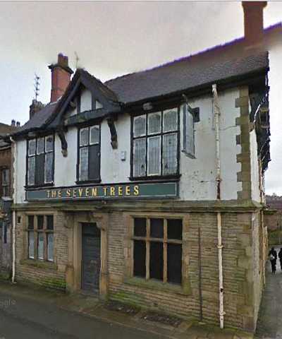
🖼️ Mosque Photo Gallery
⏰ Prayer Times
Date | Fajr | Dhuhr | Asr | Maghrib | Isha |
---|---|---|---|---|---|
07/05/25 | 03:19 AM | 12:56 PM | 05:03 PM | 08:32 PM | 10:35 PM |
08/05/25 | 03:16 AM | 12:56 PM | 05:03 PM | 08:34 PM | 10:38 PM |
09/05/25 | 03:13 AM | 12:56 PM | 05:04 PM | 08:35 PM | 10:41 PM |
10/05/25 | 03:10 AM | 12:56 PM | 05:04 PM | 08:37 PM | 10:44 PM |
11/05/25 | 03:07 AM | 12:56 PM | 05:05 PM | 08:39 PM | 10:47 PM |
12/05/25 | 03:05 AM | 12:56 PM | 05:06 PM | 08:40 PM | 10:48 PM |
13/05/25 | 03:04 AM | 12:56 PM | 05:06 PM | 08:42 PM | 10:49 PM |
14/05/25 | 03:03 AM | 12:56 PM | 05:07 PM | 08:43 PM | 10:50 PM |
15/05/25 | 03:03 AM | 12:56 PM | 05:08 PM | 08:45 PM | 10:51 PM |
16/05/25 | 03:02 AM | 12:56 PM | 05:08 PM | 08:46 PM | 10:51 PM |
🌦️ Current Weather
Location: Blackburn, Lancashire, UK
Local Time: 2025-05-07 05:52
Weather: Cloudy
Temperature
4.3 ℃ (39.7 ℉)
Wind
2.2 mph (3.6 kph)
Degree: 100
Direction: E
Gust: 4.7 mph (7.6 kph)
Weather Report
Today on May 7, 2025, the temperature will be 4.3℃ (39.7℉). It will feel like 3.9℃ (39.1℉). The wind will be 2.2 mph (3.6 kph) and humidity will be 93%.
🌤️ 3-Day Forecast
Date | Condition | Max Temp (℃/℉) | Min Temp (℃/℉) |
---|---|---|---|
![]() | Partly Cloudy | 15.1 ℃ (59.2 ℉) | 5 ℃ (41 ℉) |
![]() | Sunny | 15.6 ℃ (60.1 ℉) | 3.4 ℃ (38.1 ℉) |
![]() | Sunny | 17.7 ℃ (63.9 ℉) | 3.8 ℃ (38.8 ℉) |
🚎 Nearby Transport Links with Timetables
Loading travel information, please wait...
👨💼 Local Parliamentary Information
Display As: Mr Adnan Hussain | List As: Hussain, Mr Adnan |
MP Name: Mr Adnan Hussain MP | Gender: Male |
Constituency: Blackburn | Party Name: Independent |
Mp parliamentary email: adnan.hussain.mp@parliament.uk | Twitter: @https://x.com/AdnanHussainMP |
House Start Date: 2024-07-04 | Status: Current Member |
👮 Local Crime Data
Crime Data for Latitude: 53.76091003, Longitude: -2.47117090
Crime Categories (Highest Count First)
Category | Count | Action | |
---|---|---|---|
VIOLENT CRIME | 77 | Loading... | |
Month | Street Name | Outcome Category | Outcome Date |
2025-02 | On or near Kendal Street | Under investigation | 2025-02 |
2025-02 | On or near Langham Road | Under investigation | 2025-02 |
2025-02 | On or near Parking Area | Under investigation | 2025-02 |
2025-02 | On or near Carlton Gardens | Under investigation | 2025-02 |
2025-02 | On or near Cornelian Street | Under investigation | 2025-02 |
2025-02 | On or near Sycamore Close | Under investigation | 2025-02 |
2025-02 | On or near Ainsworth Street | Awaiting court outcome | 2025-02 |
2025-02 | On or near Parking Area | Under investigation | 2025-02 |
2025-02 | On or near Lime Street | Under investigation | 2025-02 |
2025-02 | On or near Holly Street | Under investigation | 2025-02 |
2025-02 | On or near Burnley Road | Under investigation | 2025-02 |
2025-02 | On or near St James Road | Under investigation | 2025-02 |
2025-02 | On or near West Leigh Road | Under investigation | 2025-02 |
2025-02 | On or near Parking Area | Under investigation | 2025-02 |
2025-02 | On or near New Park Street | Under investigation | 2025-02 |
2025-02 | On or near Broadfold Avenue | Under investigation | 2025-02 |
2025-02 | On or near Ainsworth Street | Under investigation | 2025-02 |
2025-02 | On or near Skiddaw Street | Under investigation | 2025-02 |
2025-02 | On or near Amber Avenue | Under investigation | 2025-02 |
2025-02 | On or near Parking Area | Under investigation | 2025-02 |
2025-02 | On or near Holly Street | Under investigation | 2025-02 |
2025-02 | On or near Sycamore Close | Under investigation | 2025-02 |
2025-02 | On or near Brown Street | Under investigation | 2025-02 |
2025-02 | On or near Ainsworth Street | Under investigation | 2025-02 |
2025-02 | On or near Warmden Gardens | Under investigation | 2025-02 |
2025-02 | On or near Cicely Street | Under investigation | 2025-02 |
2025-02 | On or near Cedar Street | Under investigation | 2025-02 |
2025-02 | On or near Cromer Place | Under investigation | 2025-02 |
2025-02 | On or near Cambridge Close | Under investigation | 2025-02 |
2025-02 | On or near Holly Terrace | Under investigation | 2025-02 |
2025-02 | On or near Stone Hill Drive | Unable to prosecute suspect | 2025-02 |
2025-02 | On or near Willoughby Street | Under investigation | 2025-02 |
2025-02 | On or near Broadfold Avenue | Under investigation | 2025-02 |
2025-02 | On or near Pleckgate Fold | Under investigation | 2025-02 |
2025-02 | On or near Rhodes Avenue | Unable to prosecute suspect | 2025-02 |
2025-02 | On or near Wharf Street | Unable to prosecute suspect | 2025-02 |
2025-02 | On or near Frederick Row | Under investigation | 2025-02 |
2025-02 | On or near Petrol Station | Local resolution | 2025-02 |
2025-02 | On or near Greenbank Way | Awaiting court outcome | 2025-02 |
2025-02 | On or near Boland Street | Local resolution | 2025-02 |
2025-02 | On or near High Street | Investigation complete; no suspect identified | 2025-02 |
2025-02 | On or near Peridot Close | Unable to prosecute suspect | 2025-02 |
2025-02 | On or near High Street | Investigation complete; no suspect identified | 2025-02 |
2025-02 | On or near Parking Area | Unable to prosecute suspect | 2025-02 |
2025-02 | On or near Aberdare Close | Unable to prosecute suspect | 2025-02 |
2025-02 | On or near Hodder Place | Investigation complete; no suspect identified | 2025-02 |
2025-02 | On or near Hill Street | Investigation complete; no suspect identified | 2025-02 |
2025-02 | On or near Ainsworth Street | Unable to prosecute suspect | 2025-02 |
2025-02 | On or near Swallowfields | Investigation complete; no suspect identified | 2025-02 |
2025-02 | On or near Birchbank Gardens | Local resolution | 2025-02 |
2025-02 | On or near Trinity Street | Local resolution | 2025-02 |
2025-02 | On or near Tintern Crescent | Local resolution | 2025-02 |
2025-02 | On or near Sports/recreation Area | Under investigation | 2025-02 |
2025-02 | On or near Glenfield Close | Local resolution | 2025-02 |
2025-02 | On or near Rhodes Avenue | Unable to prosecute suspect | 2025-02 |
2025-02 | On or near Selkirk Close | Unable to prosecute suspect | 2025-02 |
2025-02 | On or near Trinity Street | Local resolution | 2025-02 |
2025-02 | On or near Tintern Crescent | Local resolution | 2025-02 |
2025-02 | On or near The Croft | Unable to prosecute suspect | 2025-02 |
2025-02 | On or near Holly Street | Under investigation | 2025-02 |
2025-02 | On or near Limbrick | Unable to prosecute suspect | 2025-02 |
2025-02 | On or near Parking Area | Unable to prosecute suspect | 2025-02 |
2025-02 | On or near Crabtree Street | Investigation complete; no suspect identified | 2025-02 |
2025-02 | On or near High Street | Unable to prosecute suspect | 2025-02 |
2025-02 | On or near Swift Close | Unable to prosecute suspect | 2025-02 |
2025-02 | On or near Sycamore Close | Unable to prosecute suspect | 2025-02 |
2025-02 | On or near Brookhouse Close | Awaiting court outcome | 2025-02 |
2025-02 | On or near Swallowfields | Under investigation | 2025-02 |
2025-02 | On or near Providence Street | Under investigation | 2025-02 |
2025-02 | On or near Roe Lee Park | Under investigation | 2025-02 |
2025-02 | On or near Cedar Street | Under investigation | 2025-02 |
2025-02 | On or near High Street | Under investigation | 2025-02 |
ANTI SOCIAL BEHAVIOUR | 54 | Loading... | |
Month | Street Name | Outcome Category | Outcome Date |
2025-02 | On or near Zion Road | N/A | N/A |
2025-02 | On or near Cunliffe Close | N/A | N/A |
2025-02 | On or near Fort Street | N/A | N/A |
2025-02 | On or near Topaz Street | N/A | N/A |
2025-02 | On or near Old Mill Street | N/A | N/A |
2025-02 | On or near St Margarets Way | N/A | N/A |
2025-02 | On or near Cedar Court | N/A | N/A |
2025-02 | On or near Stone Hill Drive | N/A | N/A |
2025-02 | On or near Pleckgate Fold | N/A | N/A |
2025-02 | On or near Old Mill Street | N/A | N/A |
2025-02 | On or near Mossdale | N/A | N/A |
2025-02 | On or near Tintern Crescent | N/A | N/A |
2025-02 | On or near Highbank | N/A | N/A |
2025-02 | On or near Ainsworth Street | N/A | N/A |
2025-02 | On or near Parking Area | N/A | N/A |
2025-02 | On or near Lime Street | N/A | N/A |
2025-02 | On or near Parking Area | N/A | N/A |
2025-02 | On or near Bridgewater Drive | N/A | N/A |
2025-02 | On or near Aberdare Close | N/A | N/A |
2025-02 | On or near Emerald Avenue | N/A | N/A |
2025-02 | On or near Shear Brow | N/A | N/A |
2025-02 | On or near Petrol Station | N/A | N/A |
2025-02 | On or near Oxford Close | N/A | N/A |
2025-02 | On or near Mitton Street | N/A | N/A |
2025-02 | On or near Warmden Gardens | N/A | N/A |
2025-02 | On or near Willoughby Street | N/A | N/A |
2025-02 | On or near High Street | N/A | N/A |
2025-02 | On or near Lime Street | N/A | N/A |
2025-02 | On or near Aberdare Close | N/A | N/A |
2025-02 | On or near Whalley Range | N/A | N/A |
2025-02 | On or near Church Hill Road | N/A | N/A |
2025-02 | On or near Carr Street | N/A | N/A |
2025-02 | On or near Ruthin Close | N/A | N/A |
2025-02 | On or near Parking Area | N/A | N/A |
2025-02 | On or near Brownhill Drive | N/A | N/A |
2025-02 | On or near Carr Street | N/A | N/A |
2025-02 | On or near Ainsworth Street | N/A | N/A |
2025-02 | On or near High Street | N/A | N/A |
2025-02 | On or near Royshaw Avenue | N/A | N/A |
2025-02 | On or near Swallowfields | N/A | N/A |
2025-02 | On or near Bastwell Road | N/A | N/A |
2025-02 | On or near Kirkland Court | N/A | N/A |
2025-02 | On or near High Street | N/A | N/A |
2025-02 | On or near Ebony Street | N/A | N/A |
2025-02 | On or near Swift Close | N/A | N/A |
2025-02 | On or near Douglas Place | N/A | N/A |
2025-02 | On or near St James Road | N/A | N/A |
2025-02 | On or near Parking Area | N/A | N/A |
2025-02 | On or near Robinson Street | N/A | N/A |
VEHICLE CRIME | 48 | Loading... | |
Month | Street Name | Outcome Category | Outcome Date |
2025-02 | On or near New Park Street | Under investigation | 2025-02 |
2025-02 | On or near Further/higher Educational Building | Investigation complete; no suspect identified | 2025-02 |
2025-02 | On or near Langham Road | Investigation complete; no suspect identified | 2025-02 |
2025-02 | On or near Highbank | Investigation complete; no suspect identified | 2025-02 |
2025-02 | On or near Rosewood Avenue | Investigation complete; no suspect identified | 2025-02 |
2025-02 | On or near Bowness Close | Investigation complete; no suspect identified | 2025-02 |
2025-02 | On or near Highbury Place | Investigation complete; no suspect identified | 2025-02 |
2025-02 | On or near Holly Street | Investigation complete; no suspect identified | 2025-02 |
2025-02 | On or near Beresford Road | Investigation complete; no suspect identified | 2025-02 |
2025-02 | On or near Copy Nook | Investigation complete; no suspect identified | 2025-02 |
2025-02 | On or near Ramsgreave Drive | Investigation complete; no suspect identified | 2025-02 |
2025-02 | On or near Blenheim Close | Investigation complete; no suspect identified | 2025-02 |
2025-02 | On or near North Bank Avenue | Unable to prosecute suspect | 2025-02 |
2025-02 | On or near Holly Street | Investigation complete; no suspect identified | 2025-02 |
2025-02 | On or near Highbank | Investigation complete; no suspect identified | 2025-02 |
2025-02 | On or near Chestnut Avenue | Investigation complete; no suspect identified | 2025-02 |
2025-02 | On or near Heron Close | Investigation complete; no suspect identified | 2025-02 |
2025-02 | On or near Northfield Road | Investigation complete; no suspect identified | 2025-02 |
2025-02 | On or near Amber Avenue | Investigation complete; no suspect identified | 2025-02 |
2025-02 | On or near Gretna Road | Investigation complete; no suspect identified | 2025-02 |
2025-02 | On or near Paignton Road | Investigation complete; no suspect identified | 2025-02 |
2025-02 | On or near Bay Street | Investigation complete; no suspect identified | 2025-02 |
2025-02 | On or near Petrel Close | Investigation complete; no suspect identified | 2025-02 |
2025-02 | On or near Beresford Road | Investigation complete; no suspect identified | 2025-02 |
2025-02 | On or near Victoria Close | Investigation complete; no suspect identified | 2025-02 |
2025-02 | On or near Progress Avenue | Investigation complete; no suspect identified | 2025-02 |
2025-02 | On or near Percival Street | Under investigation | 2025-02 |
2025-02 | On or near Jasper Street | Investigation complete; no suspect identified | 2025-02 |
2025-02 | On or near Yew Street | Under investigation | 2025-02 |
2025-02 | On or near Boyle Street | Under investigation | 2025-02 |
2025-02 | On or near Cedar Court | Investigation complete; no suspect identified | 2025-02 |
2025-02 | On or near Regents View | Investigation complete; no suspect identified | 2025-02 |
2025-02 | On or near Highbank | Investigation complete; no suspect identified | 2025-02 |
2025-02 | On or near Beryl Avenue | Under investigation | 2025-02 |
2025-02 | On or near Gretna Road | Under investigation | 2025-02 |
2025-02 | On or near Gretna Road | Investigation complete; no suspect identified | 2025-02 |
2025-02 | On or near Paignton Road | Investigation complete; no suspect identified | 2025-02 |
2025-02 | On or near Gretna Road | Investigation complete; no suspect identified | 2025-02 |
2025-02 | On or near Wilworth Crescent | Investigation complete; no suspect identified | 2025-02 |
2025-02 | On or near Openshaw Drive | Investigation complete; no suspect identified | 2025-02 |
2025-02 | On or near Troy Court | Investigation complete; no suspect identified | 2025-02 |
2025-02 | On or near Peridot Close | Investigation complete; no suspect identified | 2025-02 |
2025-02 | On or near Sapphire Street | Investigation complete; no suspect identified | 2025-02 |
2025-02 | On or near Peridot Close | Unable to prosecute suspect | 2025-02 |
2025-02 | On or near Chestnut Avenue | Investigation complete; no suspect identified | 2025-02 |
2025-02 | On or near Wilworth Crescent | Investigation complete; no suspect identified | 2025-02 |
2025-02 | On or near Jasper Street | Investigation complete; no suspect identified | 2025-02 |
SHOPLIFTING | 19 | Loading... | |
Month | Street Name | Outcome Category | Outcome Date |
2025-02 | On or near High Street | Under investigation | 2025-02 |
2025-02 | On or near Parking Area | Under investigation | 2025-02 |
2025-02 | On or near High Street | Investigation complete; no suspect identified | 2025-02 |
2025-02 | On or near High Street | Under investigation | 2025-02 |
2025-02 | On or near High Street | Further investigation is not in the public interest | 2025-02 |
2025-02 | On or near Parking Area | Under investigation | 2025-02 |
2025-02 | On or near High Street | Investigation complete; no suspect identified | 2025-02 |
2025-02 | On or near High Street | Offender given a caution | 2025-02 |
2025-02 | On or near Parking Area | Unable to prosecute suspect | 2025-02 |
2025-02 | On or near High Street | Under investigation | 2025-02 |
2025-02 | On or near High Street | Investigation complete; no suspect identified | 2025-02 |
2025-02 | On or near High Street | Under investigation | 2025-02 |
2025-02 | On or near High Street | Investigation complete; no suspect identified | 2025-02 |
2025-02 | On or near Parking Area | Under investigation | 2025-02 |
2025-02 | On or near St Margarets Way | Under investigation | 2025-02 |
2025-02 | On or near High Street | Under investigation | 2025-02 |
BURGLARY | 16 | Loading... | |
Month | Street Name | Outcome Category | Outcome Date |
2025-02 | On or near Gladstone Way | Under investigation | 2025-02 |
2025-02 | On or near Bridgewater Drive | Under investigation | 2025-02 |
2025-02 | On or near Bancroft Avenue | Under investigation | 2025-02 |
2025-02 | On or near Sandringham Close | Under investigation | 2025-02 |
2025-02 | On or near Bridgewater Drive | Under investigation | 2025-02 |
2025-02 | On or near Kirkland Court | Under investigation | 2025-02 |
2025-02 | On or near Parking Area | Under investigation | 2025-02 |
2025-02 | On or near Sycamore Road | Under investigation | 2025-02 |
2025-02 | On or near Gladstone Way | Under investigation | 2025-02 |
2025-02 | On or near Kirkland Court | Under investigation | 2025-02 |
2025-02 | On or near Gladstone Way | Under investigation | 2025-02 |
2025-02 | On or near Amber Avenue | Under investigation | 2025-02 |
2025-02 | On or near Bridgewater Drive | Under investigation | 2025-02 |
2025-02 | On or near Pearl Close | Investigation complete; no suspect identified | 2025-02 |
2025-02 | On or near Gladstone Way | Under investigation | 2025-02 |
OTHER THEFT | 14 | Loading... | |
Month | Street Name | Outcome Category | Outcome Date |
2025-02 | On or near Cowper Street | Investigation complete; no suspect identified | 2025-02 |
2025-02 | On or near St James Road | Under investigation | 2025-02 |
2025-02 | On or near St Margarets Way | Under investigation | 2025-02 |
2025-02 | On or near St Stephen's Avenue | Under investigation | 2025-02 |
2025-02 | On or near Burnley Close | Under investigation | 2025-02 |
2025-02 | On or near Petrol Station | Under investigation | 2025-02 |
2025-02 | On or near Kendal Street | Under investigation | 2025-02 |
2025-02 | On or near Pearl Close | Investigation complete; no suspect identified | 2025-02 |
2025-02 | On or near Holly Street | Investigation complete; no suspect identified | 2025-02 |
2025-02 | On or near Rosewood Avenue | Investigation complete; no suspect identified | 2025-02 |
2025-02 | On or near Bank Hey Close | Investigation complete; no suspect identified | 2025-02 |
2025-02 | On or near Goodshaw Avenue | Local resolution | 2025-02 |
2025-02 | On or near Petrol Station | Local resolution | 2025-02 |
2025-02 | On or near Westwood Court | Unable to prosecute suspect | 2025-02 |
PUBLIC ORDER | 9 | Loading... | |
Month | Street Name | Outcome Category | Outcome Date |
2025-02 | On or near Cicely Street | Under investigation | 2025-02 |
2025-02 | On or near Bethel Road | Investigation complete; no suspect identified | 2025-02 |
2025-02 | On or near St Margarets Way | Under investigation | 2025-02 |
2025-02 | On or near Brookhouse Lane | Unable to prosecute suspect | 2025-02 |
2025-02 | On or near Wellington Street St Johns | Under investigation | 2025-02 |
2025-02 | On or near High Street | Under investigation | 2025-02 |
2025-02 | On or near Parking Area | Under investigation | 2025-02 |
2025-02 | On or near Snowdon Avenue | Under investigation | 2025-02 |
2025-02 | On or near Crabtree Street | Under investigation | 2025-02 |
CRIMINAL DAMAGE ARSON | 7 | Loading... | |
Month | Street Name | Outcome Category | Outcome Date |
2025-02 | On or near Sapphire Street | Investigation complete; no suspect identified | 2025-02 |
2025-02 | On or near Skiddaw Street | Action to be taken by another organisation | 2025-02 |
2025-02 | On or near Parking Area | Investigation complete; no suspect identified | 2025-02 |
2025-02 | On or near Cicely Street | Under investigation | 2025-02 |
2025-02 | On or near Petrol Station | Local resolution | 2025-02 |
2025-02 | On or near Amber Avenue | Investigation complete; no suspect identified | 2025-02 |
2025-02 | On or near St Gabriel's Avenue | Investigation complete; no suspect identified | 2025-02 |
DRUGS | 5 | Loading... | |
Month | Street Name | Outcome Category | Outcome Date |
2025-02 | On or near Trevor Close | Under investigation | 2025-02 |
2025-02 | On or near Langham Road | Under investigation | 2025-02 |
2025-02 | On or near Holly Street | Under investigation | 2025-02 |
2025-02 | On or near Belper Street | Under investigation | 2025-02 |
2025-02 | On or near St James Road | Under investigation | 2025-02 |
ROBBERY | 4 | Loading... | |
Month | Street Name | Outcome Category | Outcome Date |
2025-02 | On or near Langham Road | Under investigation | 2025-02 |
2025-02 | On or near Carr Street | Under investigation | 2025-02 |
2025-02 | On or near Ainsworth Street | Unable to prosecute suspect | 2025-02 |
2025-02 | On or near Parking Area | Unable to prosecute suspect | 2025-02 |
OTHER CRIME | 2 | Loading... | |
Month | Street Name | Outcome Category | Outcome Date |
2025-02 | On or near Welbeck Avenue | Under investigation | 2025-02 |
2025-02 | On or near Parking Area | Under investigation | 2025-02 |
BICYCLE THEFT | 1 | Loading... | |
Month | Street Name | Outcome Category | Outcome Date |
2025-02 | On or near High Street | Investigation complete; no suspect identified | 2025-02 |
THEFT FROM THE PERSON | 1 | Loading... | |
Month | Street Name | Outcome Category | Outcome Date |
2025-02 | On or near Kestrel Close | Investigation complete; no suspect identified | 2025-02 |